Land cover changes in the Caroni Swamp Ramsar Site, Trinidad (1942 and 2007): implications for management
- PDF / 688,057 Bytes
- 9 Pages / 595.276 x 790.866 pts Page_size
- 18 Downloads / 369 Views
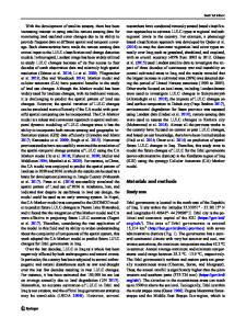
Land cover changes in the Caroni Swamp Ramsar Site, Trinidad (1942 and 2007): implications for management Rahanna A. Juman & Deanesh Ramsewak
Received: 27 June 2012 / Revised: 5 October 2012 / Accepted: 24 October 2012 / Published online: 20 November 2012 # Springer Science+Business Media Dordrecht 2012
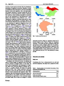
Abstract Caroni Swamp Ramsar Site, the largest mangrove dominated wetland in Trinidad and Tobago, continues to be impacted by human activities. This study examines changes in land cover and land use from 1942 to 2007 using remote sensing technology, geographic information systems (GIS) and extensive field surveys. Land cover maps were produced for 1942, 1957, 1986, 1994, 2003 and 2007 from aerial photos and high resolution satellite imagery. Caroni Swamp’s hydrology was altered in the 1920’s to facilitate rice cultivation. This resulted in the formation of large tracts of freshwater marsh. From 1942 to 1957, freshwater marsh and agriculture lands increased, but after this period there was a steady decline in both, as freshwater was diverted away from the wetland and salt water intruded further inland. Although mangrove forest was cleared for built development, its coverage has consistently increased in the Swamp from 1957, with the exception of 2003 when there was a decrease by less than 100 ha. This is in contrast to most areas in the tropics where mangrove coverage continue to decline. In this case, the mangrove trees are outcompeting/shading marsh vegetation, causing shift in the wetland communities. In the Caroni Ramsar Site, the natural wetland communities generally increased from 1942 to 2003, but declined in 2007, as built development more than doubled. The paper provides spatial coverage, and quantifies land cover from 1942 to 2007. It also identifies reasons for the changes in land cover and uses, and the implications for management. Keywords Mangroves . Agriculture . Remote sensing . GIS . Land cover . Hydrological alteration
R. A. Juman (*) : D. Ramsewak Institute of Marine Affairs, Hilltop Lane Chaguaramas, Trinidad and Tobago( WI e-mail: [email protected]
Introduction Human transformation of land to yield goods and services represents the most substantial changes to ecosystems worldwide (Millennium Ecosystem Assessment 2005; Worm et al. 2006). Material demands of production and human consumption alter land use and land cover, biodiversity, and hydro-systems locally to regionally; and waste discharge affects local to global biogeochemical cycles and climate (Grimm et al. 2008). While it is difficult to quantify alterations to marine ecosystems, changes are substantial as about 60 % of the world population lives within 100 km of the ocean (Vitousek et al. 1997). Coastal wetlands that mediate interactions between land and sea have been altered over large areas; approximately 50 % of mangrove ecosystem globally have been transformed or destroyed by human activities (World Resources Institute 1996; Valiela 2006; Valiela et al. 2009). Wetlands were once considered wastelands which would better serve nat
Data Loading...