Subsurface geophysics applied to archaeological investigation of Thabudeos Roman fortress (Biskra, Algeria)
- PDF / 13,716,496 Bytes
- 15 Pages / 595.276 x 790.866 pts Page_size
- 22 Downloads / 321 Views
ARABGU2016
Subsurface geophysics applied to archaeological investigation of Thabudeos Roman fortress (Biskra, Algeria) Amira Khouas 1 & Mohamed Hamoudi 1 & Fatma Khaldaoui 1 & Hamza Mihoubi 1 & Yacine Rabah Hadji 2
Received: 14 July 2017 / Accepted: 26 October 2017 / Published online: 5 December 2017 # Saudi Society for Geosciences 2017
Abstract Tahouda, former Roman Thabudeos, is situated 400 km south of Algiers (Algeria). It is one of the fortresses belonging to Roman south defense line in North Africa. This region is archaeologically very poorly known except for surface remains. The geophysical survey formed part of a wider research project designed to record and assess the landscape context of the longest Roman defense line in North Africa. We present the geophysical mapping and imaging using electric resistivity tomography and electromagnetics to help in investigating the subsurface properties of the region. Data were obtained using: (1) Saris resistance meter with up to 25 electrodes spaced at 2 m intervals and lines up to 50 m long. A total of 11 lines was obtained. (2) Geonics EM31, in two dipole configuration modes with 16 lines up to 100 m sampled every meter. These methods prove to be very powerful tools to This article is part of the Topical Collection on Current Advances in Geology of North Africa * Amira Khouas [email protected] Mohamed Hamoudi [email protected] Fatma Khaldaoui [email protected] Hamza Mihoubi [email protected] Yacine Rabah Hadji [email protected] 1
Laboratoire de Géophysique, FSTGAT, Université des Sciences et de la Technologie Houari Boumediene, BP32 USTHB, 16123 Bab-Ezzouar, Algiers, Algeria
2
Institut d’Archéologie, Université d’Alger 2, 2 Rue Djamal-Eddine El-Afghani, Bouzaréah, Algiers, Algeria
give insight and locate the anthropologic remains from the surface to a depth of 6 m and outline their geometry. The results obtained by the two methods are consistent above the main remains like walls and rooms. Keywords Geophysics . Archaeology . Electromagnetics . EM31 . Electrical resistivity tomography . Tahouda . Thabudeos
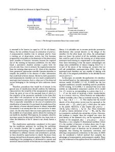
Introduction In the early ninetieth, the North African archaeology, especially Roman settlements study, was mainly conducted by military officers for history and colonization purposes (Shaw 1980). The first uses of aerial photography for archaeological purposes began in Syria during the years 1918–1919, just at the end of the World War I. Thanks to the conversion of some officers-analysts in the field of science and research to the aerial photography. The military intelligence has allowed highlighting many archaeological sites. The pioneering archaeological atlases of Tunisia by Babelon et al. (1893) and Algeria by Gsell (1911) may be considered as the leading archaeological surveys in North Africa and hence the birthplace of survey in the Mediterranean (Dyson 1982). The tradition of ground-based site recording and topographical investigation was continued in the years immediately after World War II by the aerial photographic research under
Data Loading...