A Comparative Study and Performance Analysis Using IRNSS and Hybrid Satellites
This paper deals about the visibility position accuracies of four Indian Regional Navigation Satellite System (IRNSS). The position accuracies have been determined accurately after launching the fourth satellite with respect to standard time and it is obs
- PDF / 401,734 Bytes
- 10 Pages / 439.37 x 666.142 pts Page_size
- 4 Downloads / 290 Views
Abstract This paper deals about the visibility position accuracies of four Indian Regional Navigation Satellite System (IRNSS). The position accuracies have been determined accurately after launching the fourth satellite with respect to standard time and it is observed by the receiver placed in School of Engineering and Technology, Jain University. The IRNSS satellite is independent of Global Position system (GPS). It is used for mapping, object tracking, navigation, surveying, and other services for users within the coverage area 1500 km.
⋅
Keywords Indian regional navigation satellite system Global position system Earth centered earth fixed Indian space research organization
⋅
⋅
1 Introduction In a communication system, the transmitter and receiver play a major role in data analysis and processing. In this connection the data flow from transmitter to receiver is taken care by satellites. From earlier days, GPS satellites also called as ground positioning system are used to provide a standard positioning service for users from respective base stations like navigation, tracking, mapping services, and other research activities [1]. In a GPS constellation, 24 Satellites and 6 spare Satellites are available in free space at different orbits to process, analyze, and transfer the data from one point of the world to another point [2]. Presently, Indian space research organization (ISRO) B. Kiran (✉) ⋅ N. Raghu ⋅ K.N. Manjunatha Electronics and Communication Engineering Department, School of Engineering and Technology, Jain University, Ram Nagar, Bengaluru 562112, Karnataka, India e-mail: [email protected] N. Raghu e-mail: [email protected] K.N. Manjunatha e-mail: [email protected] © Springer Science+Business Media Singapore 2017 S.C. Satapathy et al. (eds.), Proceedings of the First International Conference on Computational Intelligence and Informatics, Advances in Intelligent Systems and Computing 507, DOI 10.1007/978-981-10-2471-9_7
65
66
B. Kiran et al.
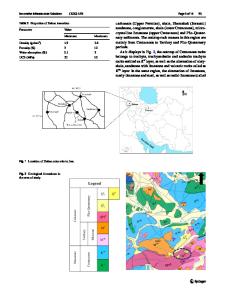
Fig. 1 IRNSS coverage area about 1500 km around the Indian land mass (image credit from ISRO)
has taken a step to develop a satellite-based navigation system called as Indian regional navigation satellite system (IRNSS) within Indian coverage area. IRNSS space segment consists of seven satellites [3]. In this, four satellites are available in free spaced to receive and transmit the Indian data within coverage area. The four launched satellites are Geo synchronous satellites, they are IRNSS 1A, IRNSS 1B, IRNSS 1C, and IRNSS 1D [4]. These satellites are working in L and S band frequency, and which carry navigation payload and C-band ranging transponder used to determine the space craft range accurately [5]. Three IRNSS satellites are geo-stationary and four IRNSS satellites are geo-system and two satellites are spares in free space. The IRNSS user segment consists of the IRNSS receiver and user community. The IRNSS receiver converts IRNSS signal into position velocity and time estimates. In a tracking operation, minimum fo
Data Loading...