A GIS-expert-based approach for groundwater quality monitoring network design in an alluvial aquifer: a case study and a
- PDF / 8,989,711 Bytes
- 20 Pages / 547.087 x 737.008 pts Page_size
- 24 Downloads / 288 Views
A GIS-expert-based approach for groundwater quality monitoring network design in an alluvial aquifer: a case study and a practical guide Kamal Taheri & Thomas M. Missimer & Vajed Amini & Jamil Bahrami & Reza Omidipour
Received: 5 May 2020 / Accepted: 28 September 2020 # Springer Nature Switzerland AG 2020
Abstract Groundwater quality monitoring is a critical part of water management in all groundwater basins. In order to be effective and to meet the required needs, groundwater quality monitoring networks (GQMNs) must be designed to be able to operate long-term and economically without minimal disruption. The analytical hierarchical process (AHP), a multi-criteria decisionmaking program, was used to design a GQMN for an alluvial aquifer located in the Islam Abad plain west of Kermanshah province, Iran. This semi-arid area is K. Taheri (*) Kermanshah Regional Water Authority (KRWA), KRWA Applied Research Group, Kermanshah, Iran e-mail: [email protected] T. M. Missimer U. A. Whitaker College of Engineering, Emergent Technologies Institute, Florida Gulf Coast University, 16301 Innovation Lane, Fort Myers, FL 33913, USA e-mail: [email protected] V. Amini Department of Geology, Faculty of Science, University of Sistan and Baluchestan, P.O. Box: 98135-674, Zahedan 9816745639, Iran e-mail: [email protected] J. Bahrami Civil Engineering Department, University of Kurdistan, Sanandaj, Iran e-mail: [email protected] R. Omidipour Department of Range and Watershed Management, Faculty of Agriculture, Ilam University, Ilam , Iran e-mail: [email protected]
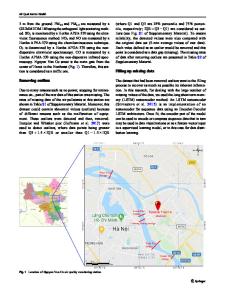
subject to groundwater depletion and water quality changes. The model used 8 primary criteria subdivided with 5 sub-criteria based on a combination of empirical data and expert opinion. The primary criteria included density of wells, well discharge, well depth, water quality (conductivity), flow direction, annual groundwater extraction, water level declines, and accessibility. The model showed that 59 of 254 production wells in the basin could provide optimal monitoring locations. When a second screening of the wells was used to determine constraints (physical conditions of the wells and pumps, owner permission of use, type of the pump, etc.), the number of wells was reduced to 13 wells. An initial round of water sampling and chemical analysis demonstrated that the design of the GQMN met the goals of the water management agency of the region. Keywords Groundwater quality monitoring . Alluvial aquifer . Analytical hierarchical process
Introduction Groundwater is the primary supply source for many urban and industrial infrastructure development programs as well as for rural and agricultural land uses. This valuable resource is the only source of drinking water in many parts of the world (UNESCO 2009; Zektser and Everett 2004). These fresh-water resources are of critical importance in arid and semi-arid regions where climate change events, such as long-term droughts, are an integral part of water-use planning.
684
Page 2 of 20
Groundwater management c
Data Loading...