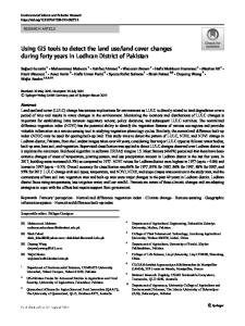
Land suitability analysis for wheat and sorghum crops in Wogdie District, South Wollo, Ethiopia, using geospatial tools
- PDF / 1,019,890 Bytes
- 10 Pages / 595.276 x 790.866 pts Page_size
- 41 Downloads / 266 Views
ORIGINAL PAPER
Land suitability analysis for wheat and sorghum crops in Wogdie District, South Wollo, Ethiopia, using geospatial tools Mohammed Motuma 1 & K.V. Suryabhagavan 1 & M. Balakrishnan 2
Received: 22 December 2014 / Accepted: 14 January 2016 # Società Italiana di Fotogrammetria e Topografia (SIFET) 2016
Abstract Land suitability analysis is the process of evaluation of a specific area of land in terms of suitability for a defined use. Land suitability analysis for agricultural crops is an important modern step to identify suitable and sustainable land use practices in order to get optimum benefits out of the land. In the present study, physical land suitability analysis for wheat and sorghum crops in Wogdie District, South Wollo in Ethiopia, was made using geospatial techniques. Parametric square root test mathematical formula was applied to identify suitability levels of the land for these crops. Factors considered in the evaluation were depth, texture, organic carbon, drainage and type of soil, slope, temperature, and rainfall. Out of the total extent of 1101 km2, 20.5 and 79.5 % of the extents were classified as moderately suitable and marginally suitable, respectively, for wheat, and 3.3, 93, and 3.7 % of the extents were classified as moderately suitable, marginally suitable, and currently not suitable for sorghum, respectively. In the present study area, no land was classified as highly suitable and currently and permanently not suitable for wheat, and highly suitable and permanently not suitable for sorghum. Results of the present investigation indicate that long-term irrigation activities would affect land suitability for agricultural potentiality of the area. Integrating parametric square root test method with geospatial technology in land suitability analysis for agricultural crops can be used as a useful tool to
* K.V. Suryabhagavan [email protected]
1
School of Earth Sciences, Addis Ababa University, P.O. Box 1176, Addis Ababa, Ethiopia
2
Department of Zoological Sciences, Addis Ababa University, P.O. Box 1176, Addis Ababa, Ethiopia
select areas for different crop production in various landscapes. Keywords Geospatial technique . Land utilization type . Parametric method
Introduction To meet the ever increasing demands for food to support the exponentially growing human population, farming community has been working hard to bring more and more land under various farming activities to produce more food. However, under the present situation where the land mass is a limiting factor, it is impossible to bring more areas for extensive farming. Hence, farming community has been trying to tackle this challenge through intensive farming in the land already being used for farming, using modern technologies to increase food production. Higher productivity, profitability, and health of humankind, as well as environmental factors, are concerns of modern agriculture. In this context, eco-friendly practices have paved way for the concepts such as precision farming, sustainable farming, and o
Data Loading...