Extreme water levels along the central Red Sea coast of Saudi Arabia: processes and frequency analysis
- PDF / 7,547,932 Bytes
- 18 Pages / 439.37 x 666.142 pts Page_size
- 36 Downloads / 501 Views
Extreme water levels along the central Red Sea coast of Saudi Arabia: processes and frequency analysis Charls Antony1 · Sabique Langodan1 · Hari Prasad Dasari1 · Omar Knio1 · Ibrahim Hoteit1 Received: 4 March 2020 / Accepted: 10 October 2020 © Springer Nature B.V. 2020
Abstract Knowledge about extreme water levels is essential for efficient planning and design of coastal infrastructure. This study uses a high-resolution (~ 60 m) coupled advanced circulation + simulating waves nearshore modeling system to estimate extreme water levels in the coastal waters of King Abdullah Economic City (KAEC), Saudi Arabia, located on the central eastern coast of the Red Sea. High spatial (5 km) and temporal (hourly) resolution meteorological fields are generated to drive the model, along with open ocean tides. The characteristics of extreme water levels in the region are subsequently described based on the validated model simulations. The central Red Sea is characterized by a low-tidal regime, and meteorological events contribute significantly to total water levels: meteorological surges cause water level increases of up to 75 cm inside the KAEC lagoon. An extreme value analysis based on annual maxima of hindcast water level data is conducted and the results suggest that the inferred 100-year water levels are about 80 cm inside the KAEC lagoon. It is also shown that projected sea level rise would reduce the average recurrence intervals of extreme water levels along the KAEC coastline. Keywords Red Sea · Saudi Arabia · King abdullah economic city · Extreme sea levels · Meteorological surges · Return periods
1 Introduction Knowledge about extreme water level characteristics and their impacts is crucial to minimize associated risks and develop effective plans and mitigation measures. Determining the probability of extreme events is also necessary for coastal application aspects, and conducting a frequency analysis of extreme water levels is useful when designing various coastal structures (Mclnnes et al. 2003). In this respect, long-term tide gauge data can be analyzed to estimate the risk of flooding using various statistical analysis techniques (Haigh et al. 2010). However, long-term tide gauge data for the Red Sea are limited, and * Ibrahim Hoteit [email protected] 1
Physical Science and Engineering Division, King Abdullah University of Science and Technology (KAUST), Thuwal 23955‑6900, Saudi Arabia
13
Vol.:(0123456789)
Natural Hazards
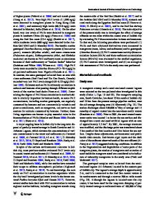
advanced numerical model outputs are the main source of information to obtain long-term water level data. The Red Sea is an elongated semi-enclosed marginal sea in the Indian Ocean (Fig. 1). It connects to the Gulf of Aden in the south via a narrow strait called Bab-el-Mandeb, which has a width of 25 km and maximum depth of only 137 m at the Hanish Sill. In the north, the basin branches into two smaller Gulfs: the Gulf of Suez and Gulf of Aqaba. Several studies on surface winds over the Red Sea have been conducted over the past (Langodan et al. 2017; Viswanadhapalli et al.
Data Loading...