Recent crustal deformation and seismicity studies at Abu-Dabbab area, Red Sea, Egypt
- PDF / 1,159,685 Bytes
- 11 Pages / 595.276 x 790.866 pts Page_size
- 57 Downloads / 285 Views
ORIGINAL PAPER
Recent crustal deformation and seismicity studies at Abu-Dabbab area, Red Sea, Egypt Abdel-Monem S. Mohamed & M. Saleh & S. Mahmoud & A. Teleab & A. A. Othman & Diaa Hamed
Received: 29 May 2011 / Accepted: 27 September 2011 / Published online: 6 October 2011 # Saudi Society for Geosciences 2011
Abstract The Abu-Dabbab area is characterized by high seismicity and complex tectonic setting; for these facts, a local geodetic network consisting of 11 geodetic benchmarks has been established. The crustal deformation data in this area are collected using the GPS techniques. Five campaigns of GPS measurements have been collected, processed, and adjusted to get the more accurate positions of the GPS stations. The horizontal velocity vectors, the dilatational, the maximum shear strains, and the principal strain rates were estimated. The horizontal velocity varies in average between 3 and 6 mm per year across the network. The results of the deformation analysis indicate a significant contraction and extension across the southern central part of the study area which is characterized by high seismic activity represented by the clustering shape of the microearthquakes that trending ENE. The north and northeastern parts are characterized by small strain rates. This study is an attempt to provide valuable information about the present state of the crustal deformation and its relationship to seismic activity and tectonic setting at the Abu-Dabbab area. The present study is the first work demonstrating crustal deformation monitoring at the AbuDabbab area. The time interval is relatively short. Actually, these results are preliminary results. So, the continuity of GPS measurements is needed for providing more information about the recent crustal deformation in that area.
A.-M. S. Mohamed (*) : M. Saleh : S. Mahmoud : A. Teleab National Research Institute of Astronomy and Geophysics, Helwan, Egypt e-mail: [email protected] A. A. Othman : D. Hamed Geology Department, Faculty of Science, Al-Azhar University, Nasr City, Cairo, Egypt
Keywords Seismicity . Crustal deformation . Abu-Dabbab area
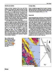
Introduction The Abu-Dabbab area is located in the central part of the Eastern Desert of Egypt at latitudes 25.0–25.6° N and longitudes 34.2–34.9° E, 27 km inland from the Red Sea coast. Apart from nomadic Bedouins, the eastern desert is essentially the unpopulated east of the River Nile, with small populated developments on the relatively narrow but variable width coastal plain. The key map of the AbuDabbab area is shown in Fig. 1. The area is a part of the Red Sea mountain range, which consists essentially of backbone of high and rugged mountains parallel to the Red Sea coast, the greater part of which is covered by Late Proterozoic basement rocks of the Nubian Shield (Said 1962). Its mountains were pen planed, and its sediments were highly deformed and metamorphosed. Three main wadies, Wadi Abu-Dabbab, Wadi Mubarak, and Wadi Dabr, and their tributaries drain the Abu-Dabbab area.
Tectonic settings The Arabo Nubian massif occ
Data Loading...