GIS-based assessment of climate change impacts on forest habitable Aframomum corrorima (Braun) in Southwest Ethiopia cof
- PDF / 3,668,730 Bytes
- 15 Pages / 595.22 x 842 pts (A4) Page_size
- 29 Downloads / 247 Views
e-mail: [email protected]
http://jms.imde.ac.cn
GIS-based assessment of climate change impacts on forest habitable Aframomum corrorima (Braun) in Southwest Ethiopia coffee forest Ayehu FEKADU1*
https://orcid.org/0000-0002-4326-0481;
Teshome SOROMESSA1 Bikila Warkineh DULLO2
e-mail: [email protected]
https://orcid.org /0000-0002-9204-7046; e-mail: [email protected] https://orcid.org/0000-0002-8488-4020; e-mail: [email protected]
*Corresponding author 1 Center of Environmental Science, Addis Ababa University, P.O. Box 1176, Addis Ababa, Ethiopia 2 Department of Plant Biology and Biodiversity Management, Addis Ababa University, P.O. Box 1176, Addis Ababa, Ethiopia Citation: Fekadu A, Soromessa T, Dullo BW (2020) GIS-based assessment of climate change impacts on forest habitable Aframomum corrorima (Braun) in Southwest Ethiopia coffee forest. Journal of Mountain Science 17(10). https://doi.org/10.1007/s11629-019-5722-2
© Science Press, Institute of Mountain Hazards and Environment, CAS and Springer-Verlag GmbH Germany, part of Springer Nature 2020
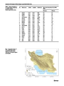
Abstract: Climate change is thought to have a greater impact on crops that require particular conditions for their productivity. Southwest Ethiopia is a region where important cash crops such as Coffea arabica and Aframomum corrorima (korerima) originate. These crops are known to require shade for their growth and productivity. This study was conducted to assess the impacts of climate change on an important but neglected cash crop of A. corrorima using GIS-based species distribution approaches. Local meteorological data and bioclimatic data from WorldClim were used to map past, present, and future distribution of the crop in the Coffee Forest System of Southwest Ethiopia. Moreover, 96 key informants were interviewed and completed questionnaires to complement the distribution modeling. The key informants mapped the history and present occurrences of A. corrorima and based on this, ground-truthing survey was conducted. The interpolation method of the Inverse Distance Weighted was used in ArcGIS 10.5 to develop bioclimatic variables for modeling past and present distribution while data from IPCC (AR4) Emissions Scenarios was used for the future occurrence Received: 08-Aug-2019 1st Revision: 11-Feb-2020 2nd Revision: 16-Mar-2020 3rd Revision: 24-Apr-2020 Accepted: 13-May-2020
2432
prediction using Principal Component Analysis. Eleven best bioclimatic variables were selected and MaxEnt was used to model past, present and future distribution of A. corrorima. The output of our model was validated using Area Under the Curve (AUC) approach. Temperature and precipitation are the most important environmental variable, then temperature increased by 1.3°C in the past (from 1988 to 2018) while it is predicted to increase further by at least 1.4°C before 2050. On the contrary, precipitation decreased by an average of 10.1 mm from the past while it is predicted to decrease further by 12.5 mm before 2050. Our model shows that the area suitable for korerima in
Data Loading...