Moho modeling of the Yellow Sea (West Sea) from spectrally correlated free-air and terrain gravity data
- PDF / 9,237,329 Bytes
- 10 Pages / 595 x 842 pts (A4) Page_size
- 97 Downloads / 276 Views
Geosciences Journal
GJ
Moho modeling of the Yellow Sea (West Sea) from spectrally correlated free-air and terrain gravity data Hyung Rae Kim1,2*, Soon-Young Choi3, Mancheol Suh1, Ralph R.B. von Frese4, Kyung Jun Park1, and Haeun Yu1 1
Department of GeoEnvironmental Sciences, Kongju National University, 56, Gongjudaehak-ro, Gongju-si, Chungcheongnam-do 32588, Republic of Korea 2 Yellow Sea GeoEnvironmental Institute, Kongju National University, 56, Gongjudaehak-ro, Gongju-si, Chungcheongnam-do 32588, Republic of Korea 3 Dokdo Research Center, Korea Institute of Ocean Sciences and Technology, 48, Haeyanggwahak-gil, Jukbyeon-myeon, Uljin-gun, Gyeongsangbuk-do 36315, Republic of Korea 4 School of Earth Sciences, The Ohio State University, 275 Mendenhall Laboratory, 125 South Oval Mall, Columbus, Ohio 43210, USA
ABSTRACT: Moho estimates for the Yellow Sea and Bohai Basin were developed from the EGM2008 gravity, ETOPO1 topography/bathymetry, and NOAA’s sedimentary thickness databases. Spectral correlation analysis between the free-air gravity anomalies (FAGA) and the terrain’s gravity effects (TGE) at 20 km altitude was made to estimate the terrain-correlated FAGA, which can provide information on the isostatic status of the study area. This study included the additional terrain gravity effects due to density contrasts from sedimentary rock thickness variations over the Yellow Sea. Spectral correlation filtering of the FAGA with the TGE estimated the terrain correlated FAGA, which were subtracted from the TGE to infer isostatically compensated gravity effects for inversion constraints on the Moho modeling. The derived Moho estimates show considerable sensitivity to the sedimentary thickness variations and tectonic features of the Yellow Sea region. In addition, the gradients in the dynamic crustal topography inferred from the terrain-correlated FAGA show apparent associations with the distribution of the Yellow Sea’s earthquakes with predominantly strike-slip focal mechanisms. Key words: Yellow Sea, Moho, EGM2008, ETOPO1, sedimentary rock thickness, sedimentary basins, gravity Manuscript received September 15, 2019; Manuscript accepted November 26, 2019
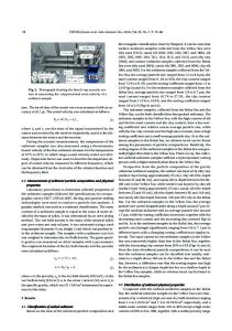
1. INTRODUCTION The Yellow Sea (a.k.a. West Sea of Korea) between the mainland China and Korean Peninsula, as shown in Figure 1a, hosts several large sedimentary basins covering an area of about 380,000 km2 (Wu et al., 2008). Its broad and flat seafloor maintains a shallow mean depth of about 44 m. The Qinling-Dabie-Sulu (QDS) collision belt divides the North Yellow Sea Basin (NYSB) from the South Yellow Sea Basin (SYSB) (Zhang, 1997). Additional basins include the West Korea Bay Basin (WKB) between the Korean Peninsula and the NYSB and the Bohai Basin (BB) *Corresponding author: Hyung Rae Kim Department of GeoEnvironmental Sciences, Kongju National University, 56, Gongjudaehak-ro, Gongju-si, Chungcheongnam-do 32588, Republic of Korea Tel: +82-41-850-8516, Fax: +82-41-856-8763, E-mail: [email protected]
©The Association of Korean Geoscience Societies and Springer 2
Data Loading...